
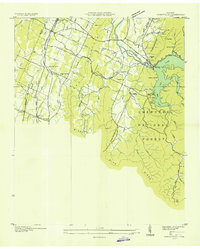
1935 Map of East Cleveland
USGS Topo · Published 1935About this map
Tasso and the outlying districts of North Cleveland and East Cleveland appear here as they were during the mid-1930s, defined by a landscape of ridges and valleys. The Tennessee Electric Power Company Transmission Line and the Southern Railway slice through the terrain, illustrating the infrastructure of the Tennessee Valley Authority era. Local industry and rural life are well-documented, from the Barite Mine and several Quarries to Hauns Mill on Chatata Creek. The map provides a remarkable genealogical record, naming numerous community centers such as the Michigan Avenue Sch, Julian Chapel, and the CCC Camp No 3466. Notable family-named landmarks like McKenzie Spring and Richey Spring are scattered across Little Valley and Chatata Valley, highlighting the importance of natural water sources before widespread municipal expansion.
Find a feature on this map
50 named features on this map. Tap any name to fly to it.
Don’t see what you’re looking for? This feature index may not catch every label — zoom into the map to look around manually.
Map Details
Editions of this 1935 East Cleveland Map
This is the sole edition of this map. No revisions or reprints were ever made.
Other maps of this area

1886 · Cleveland
USGS Topo · 1:125,000

1892 · Cleveland
USGS Topo · 1:125,000

1895 · Cleveland
USGS Topo · 1:125,000

1901 · Cleveland
USGS Topo · 1:125,000

1935 · Mc Donald
USGS Topo · 1:24,000

1935 · Calhoun
USGS Topo · 1:24,000

1935 · Benton
USGS Topo · 1:24,000

1935 · Felker
USGS Topo · 1:24,000

1935 · Charleston
USGS Topo · 1:24,000
1935 · Parksville
USGS Topo · 1:24,000