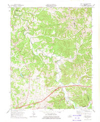
1973 Map of East Fork
USGS Topo · Published 1974About this map
Little Barren River carves a winding path through this central Kentucky landscape, defining the character of the region during the 1970s. The map illustrates a rural society organized around small crossroads and family congregations, such as Foundation Ch and Union Chapel. While much of the land remains agricultural, the presence of Oil Wells and a Gas Well indicates the underlying mineral activity prevalent in this part of Metcalfe County.
Find a feature on this map
37 named features on this map. Tap any name to fly to it.
Don’t see what you’re looking for? This feature index may not catch every label — zoom into the map to look around manually.
Map Details
Editions of this 1973 East Fork Map
This is the sole edition of this map. No revisions or reprints were ever made.
Other maps of this area

1953 · Gradyville
USGS Topo · 1:24,000

1953 · Sulphur Well
USGS Topo · 1:24,000

1953 · Breeding
USGS Topo · 1:24,000

1953 · Edmonton
USGS Topo · 1:24,000

1953 · Summer Shade
USGS Topo · 1:24,000

1953 · Exie
USGS Topo · 1:24,000

1953 · Gresham
USGS Topo · 1:24,000

1953 · Center
USGS Topo · 1:24,000

1953 · East Fork
USGS Topo · 1:24,000

1956 · Corbin
USGS Topo · 1:250,000