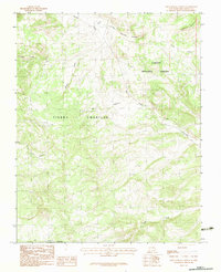
1983 Map of East Gavilan Canyon
USGS Topo · Published 1983About this map
The Tierra Amarilla Grant Bdy defines much of this high-elevation landscape in Northern New Mexico, illustrating the enduring influence of historic land grants on regional geography. This 1983 provisional survey captures a network of waterways that drain the southern slopes of Jawbone Mountain, including Gavilan Creek, Encinado Creek, and the upper reaches of the Rio Vallecitos. These streams descend through the protected acreage of the Carson National Forest, where the terrain is marked by steep canyons and seasonal springs.
Find a feature on this map
12 named features on this map. Tap any name to fly to it.
Don’t see what you’re looking for? This feature index may not catch every label — zoom into the map to look around manually.
Map Details
Editions of this 1983 East Gavilan Canyon Map
This is the sole edition of this map. No revisions or reprints were ever made.
Other maps of this area

1918 · Tusas
USGS Topo · 1:125,000

1954 · Aztec
USGS Topo · 1:250,000

1955 · Cebolla
USGS Topo · 1:62,500

1955 · Brazos Peak
USGS Topo · 1:62,500

1958 · Aztec
USGS Topo · 1:250,000

1962 · Aztec
USGS Topo · 1:250,000

1963 · Broke Off Mountain
USGS Topo · 1:24,000

1963 · Burned Mountain
USGS Topo · 1:24,000
1963 · Canon Plaza
USGS Topo · 1:24,000

1965 · Aztec
USGS Topo · 1:250,000