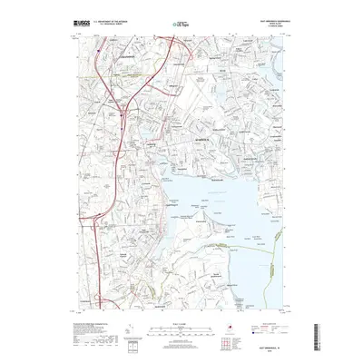
2018 Map of East Greenwich
USGS Topo · Published 2018About this map
The coastal landscapes of Warwick and Cranston meet the waters of Greenwich Bay in this detailed survey, where established suburban neighborhoods blend with deep historical roots. The area is dominated by the sprawling grounds of the Theodore Francis Green State Airport and the educational campus of the Community College of Rhode Island. Along the indented shoreline, numerous coves like Apponaug Cove and Warwick Cove highlight the region's enduring connection to the Atlantic Ocean.
Find a feature on this map
174 named features on this map. Tap any name to fly to it.
Don’t see what you’re looking for? This feature index may not catch every label — zoom into the map to look around manually.
Map Details
Editions of this 2018 East Greenwich Map
This is the sole edition of this map. No revisions or reprints were ever made.
Other maps of this area

1887 · Providence
USGS Topo · 1:62,500

1889 · Providence
USGS Topo · 1:62,500

1889 · Burrillville
USGS Topo · 1:62,500

1890 · Narragansett Bay
USGS Topo · 1:62,500

1890 · Kent
USGS Topo · 1:62,500

1892 · Narragansett Bay
USGS Topo · 1:62,500

1894 · Burrillville
USGS Topo · 1:62,500

1894 · Kent
USGS Topo · 1:62,500

1894 · Providence
USGS Topo · 1:62,500

1915 · Burrillville
USGS Topo · 1:62,500