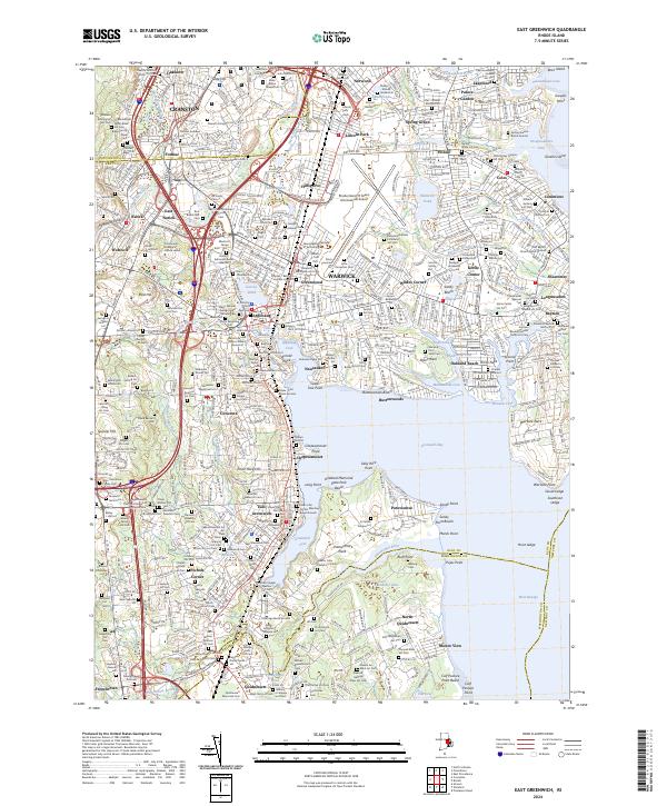
2024 Map of East Greenwich
USGS Topo · Published 2024About this map
Greenwich Bay and the interconnected coves of the Warwick shoreline anchor this coastal study, revealing a landscape where colonial-era lineage meets modern transit infrastructure. The prominent Rhode Island/TF Green International Airport occupies the center of the sheet, surrounded by historic villages like Apponaug, Hillsgrove, and Pontiac. This area is exceptionally dense with genealogical data, featuring dozens of family burial plots and small cemeteries such as the Major General George Sears Greene Cem and the Baker Family Slave Cem, which offer significant insights into the early settlement patterns and social history of the region.
Find a feature on this map
235 named features on this map. Tap any name to fly to it.
Don’t see what you’re looking for? This feature index may not catch every label — zoom into the map to look around manually.
Map Details
Editions of this 2024 East Greenwich Map
This is the sole edition of this map. No revisions or reprints were ever made.
Other maps of this area

1887 · Providence
USGS Topo · 1:62,500

1889 · Providence
USGS Topo · 1:62,500

1889 · Burrillville
USGS Topo · 1:62,500

1890 · Narragansett Bay
USGS Topo · 1:62,500

1890 · Kent
USGS Topo · 1:62,500

1892 · Narragansett Bay
USGS Topo · 1:62,500

1894 · Burrillville
USGS Topo · 1:62,500

1894 · Kent
USGS Topo · 1:62,500

1894 · Providence
USGS Topo · 1:62,500

1915 · Burrillville
USGS Topo · 1:62,500