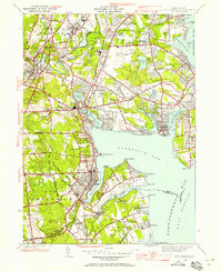
1942 Map of East Greenwich
USGS Topo · Published 1958About this map
The City of Warwick and surrounding coastal towns are shown here in 1942, reflecting a mix of institutional land use and maritime industry. Large public facilities dominate the northern landscape, including the State Prison and State Farm near Howard, alongside the early development of the State Airport in Hillsgrove. The coastline is heavily marked by numerous coves and inlets, from Apponaug Cove to Occupessatuxet Cove, where the New York New Haven and Hartford railroad tracks parallel the shore, connecting the region's commercial centers.
Find a feature on this map
103 named features on this map. Tap any name to fly to it.
Don’t see what you’re looking for? This feature index may not catch every label — zoom into the map to look around manually.
Map Details
Editions of this 1942 East Greenwich Map
This is the sole edition of this map. No revisions or reprints were ever made.
Other maps of this area

1887 · Providence
USGS Topo · 1:62,500

1889 · Providence
USGS Topo · 1:62,500

1889 · Burrillville
USGS Topo · 1:62,500

1890 · Narragansett Bay
USGS Topo · 1:62,500

1890 · Kent
USGS Topo · 1:62,500

1892 · Narragansett Bay
USGS Topo · 1:62,500

1894 · Burrillville
USGS Topo · 1:62,500

1894 · Kent
USGS Topo · 1:62,500

1894 · Providence
USGS Topo · 1:62,500

1915 · Burrillville
USGS Topo · 1:62,500