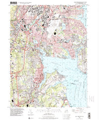
1996 Map of East Greenwich
USGS Topo · Published 2000About this map
The Pawtuxet River winds through this urban and coastal corridor of Rhode Island, defining the boundary between industrial and residential history. Along the northern reaches, the map details the infrastructure of Howard and Pontiac, while the eastern shoreline is dominated by the sprawling Theodore Francis Green State Airport. The coastline of Greenwich Bay reveals a landscape of summer colonies and maritime activity, notably at Oakland Beach and the extensive grounds of Goddard Memorial State Park.
Find a feature on this map
109 named features on this map. Tap any name to fly to it.
Don’t see what you’re looking for? This feature index may not catch every label — zoom into the map to look around manually.
Map Details
Editions of this 1996 East Greenwich Map
This is the sole edition of this map. No revisions or reprints were ever made.
Other maps of this area

1887 · Providence
USGS Topo · 1:62,500

1889 · Providence
USGS Topo · 1:62,500

1889 · Burrillville
USGS Topo · 1:62,500

1890 · Narragansett Bay
USGS Topo · 1:62,500

1890 · Kent
USGS Topo · 1:62,500

1892 · Narragansett Bay
USGS Topo · 1:62,500

1894 · Burrillville
USGS Topo · 1:62,500

1894 · Kent
USGS Topo · 1:62,500

1894 · Providence
USGS Topo · 1:62,500

1915 · Burrillville
USGS Topo · 1:62,500