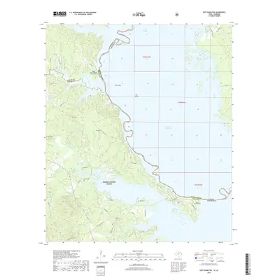
2019 Map of East Hamilton
USGS Topo · Published 2019About this map
East Hamilton sits at the edge of the Toledo Bend Reservoir, where the state boundary between Texas and Louisiana follows the submerged path of the old riverbed. This recent survey captures the modern shoreline and the extensive protected lands of the Sabine National Forest. The landscape is defined by the transition from upland woods to the expansive water, with fingers of the reservoir reaching into deep inlets like Patroon Bayou and Boughs Cr. Numerous family burial grounds, including McGuire Cem, Alford Cem, and Liberty Springs Cem, are preserved throughout the forest and along the winding roads that lead to the water's edge. Local infrastructure is represented by routes such as W Carters Ferry Rd and Nine Mile Rd, reflecting the historical importance of ferries and early transit corridors in this border region.
Find a feature on this map
49 named features on this map. Tap any name to fly to it.
Don’t see what you’re looking for? This feature index may not catch every label — zoom into the map to look around manually.
Map Details
Editions of this 2019 East Hamilton Map
This is the sole edition of this map. No revisions or reprints were ever made.
Other maps of this area

1941 · Zwolle
USGS Topo · 1:62,500

1944 · Negreet
USGS Topo · 1:62,500

1944 · Patroon
USGS Topo · 1:62,500

1944 · Zwolle
USGS Topo · 1:62,500

1953 · Alexandria
USGS Topo · 1:250,000

1954 · Negreet
USGS Topo · 1:62,500

1954 · Salter Creek
USGS Topo · 1:24,000

1955 · Alexandria
USGS Topo · 1:250,000

1956 · Patroon
USGS Topo · 1:62,500
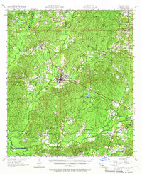
1957 · Zwolle
USGS Topo · 1:62,500