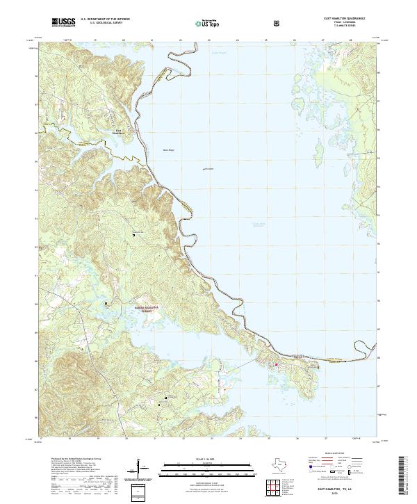
2022 Map of East Hamilton
USGS Topo · Published 2022About this map
Sabine National Forest dominates the western landscape of this border region, where the winding Sabine River defines the boundary between Texas and Louisiana. The terrain is a complex network of bayous and branches, including Patroon Bayou and Bourghs Cr, which drain into the expansive Toledo Bend Reservoir. This 2022 survey illustrates a modern landscape still defined by its natural features and small, family-associated landmarks. Near the settlement of East Hamilton, the geography transitions from the upland heights of Bone Ridge to the submerged features of the reservoir, such as Ball Island. Genealogists will find significant value in the distribution of local burial grounds scattered across the forest and shoreline, including Bennett Cem, Harvey Cem, and Moran Loving Cem. The road network, including W Carters Ferry Rd and E Hamilton, reveals how contemporary access routes follow the historical contours of the river valley.
Find a feature on this map
56 named features on this map. Tap any name to fly to it.
Don’t see what you’re looking for? This feature index may not catch every label — zoom into the map to look around manually.
Map Details
Editions of this 2022 East Hamilton Map
This is the sole edition of this map. No revisions or reprints were ever made.
Other maps of this area

1941 · Zwolle
USGS Topo · 1:62,500

1944 · Negreet
USGS Topo · 1:62,500

1944 · Patroon
USGS Topo · 1:62,500

1944 · Zwolle
USGS Topo · 1:62,500

1953 · Alexandria
USGS Topo · 1:250,000

1954 · Negreet
USGS Topo · 1:62,500

1954 · Salter Creek
USGS Topo · 1:24,000

1955 · Alexandria
USGS Topo · 1:250,000

1956 · Patroon
USGS Topo · 1:62,500
1957 · Zwolle
USGS Topo · 1:62,500