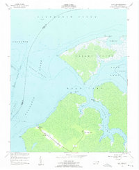
1953 Map of East Lake
USGS Topo · Published 1956About this map
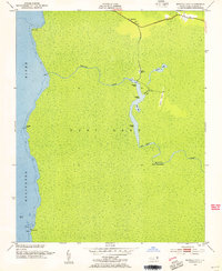
Albemarle Sound and the Alligator River define this coastal landscape, where the boundary between Tyrrell and Dare counties meets at the water's edge. The small settlements of East Lake Landing and East Lake serve as the primary hubs on the mainland, connected by Route 64. This 1950s survey captures a community deeply tied to the water, where a Ferry crossing remains a critical link across the river before modern infrastructure dominated the region.
Find a feature on this map
32 named features on this map. Tap any name to fly to it.
Don’t see what you’re looking for? This feature index may not catch every label — zoom into the map to look around manually.
Map Details
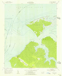
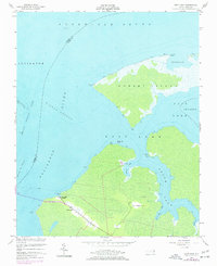
Editions of this 1953 East Lake Map
Other maps of this area

1940 · Powells Point
USGS Topo · 1:62,500

1940 · Wade Point
USGS Topo · 1:62,500

1943 · Wade Point
USGS Topo · 1:62,500

1943 · Columbia
USGS Topo · 1:125,000

1943 · Roanoke Island
USGS Topo · 1:125,000

1946 · Eastville
USGS Topo · 1:250,000

1946 · Currituck Sound
USGS Topo · 1:250,000
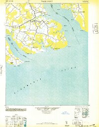
1948 · Wade Point
USGS Topo · 1:62,500

1953 · Norfolk
USGS Topo · 1:250,000
1953 · Buffalo City
USGS Topo · 1:24,000