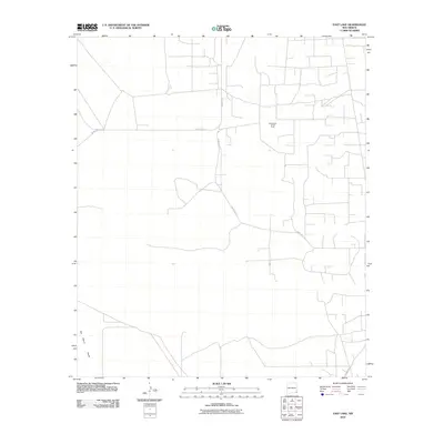
2010 Map of East Lake
USGS Topo · Published 2010About this map
San Simon Swale dominates the southern landscape of this Lea County region, defining the local topography in this 2010 U.S. Geological Survey study. The area is characterized by the industrial footprint of the Monument Jal Oil Field, which is serviced by a dense network of local routes including County Rd-21 and County Rd-11. This map captures the intersection of natural depressions and heavy resource extraction in southeastern New Mexico. The grid-like system of unnamed access roads branching off County Rd-8 highlights the intensive land use required for energy production during this era. Unlike traditional residential townships, the settlement pattern here is dictated entirely by the requirements of the oil field, providing a clear record of the infrastructure supporting the Permian Basin's economy.
Find a feature on this map
5 named features on this map. Tap any name to fly to it.
Don’t see what you’re looking for? This feature index may not catch every label — zoom into the map to look around manually.
Map Details
Editions of this 2010 East Lake Map
This is the sole edition of this map. No revisions or reprints were ever made.
Other maps of this area

1954 · Hobbs
USGS Topo · 1:250,000

1958 · Hobbs
USGS Topo · 1:250,000

1963 · Oil Center
USGS Topo · 1:62,500

1969 · Eunice
USGS Topo · 1:24,000

1969 · Jal NW
USGS Topo · 1:24,000

1969 · Rattlesnake Canyon
USGS Topo · 1:24,000

1973 · Custer Mountain
USGS Topo · 1:24,000
1973 · Woodley Flat
USGS Topo · 1:24,000

1978 · Jal
USGS Topo · 1:100,000

1984 · Oil Center
USGS Topo · 1:24,000