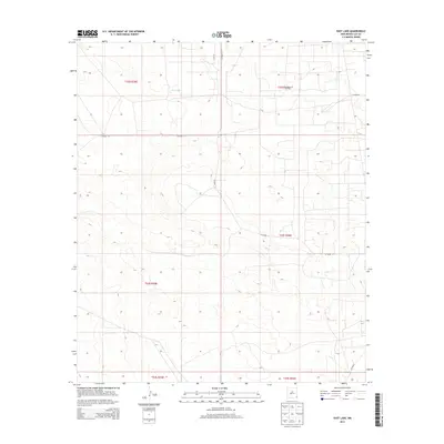
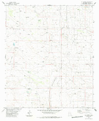
2013 Map of East Lake
USGS Topo · Published 2013About this map
East Lake and the industrial infrastructure of the Monument Jal Oil Field define this portion of the Permian Basin in southeastern New Mexico. The landscape is characterized by a dense grid of section lines and energy development, with a network of local routes including Co Road 21 and Co Road 11 providing access across the arid terrain. While largely open and undeveloped in the traditional residential sense, the map reveals the systematic partitioning of the land into townships such as t22s r35e and t23s r36e, reflecting the region's importance to the state's resource economy. The presence of the lake provides a rare hydrographic landmark in a territory otherwise dominated by the geometric patterns of oil and gas extraction roads.
Find a feature on this map
13 named features on this map. Tap any name to fly to it.
Don’t see what you’re looking for? This feature index may not catch every label — zoom into the map to look around manually.
Map Details
Editions of this 2013 East Lake Map
This is the sole edition of this map. No revisions or reprints were ever made.
Other maps of this area

1954 · Hobbs
USGS Topo · 1:250,000

1958 · Hobbs
USGS Topo · 1:250,000
1963 · Oil Center
USGS Topo · 1:62,500
1969 · Eunice
USGS Topo · 1:24,000
1969 · Jal NW
USGS Topo · 1:24,000
1969 · Rattlesnake Canyon
USGS Topo · 1:24,000
1973 · Custer Mountain
USGS Topo · 1:24,000
1973 · Woodley Flat
USGS Topo · 1:24,000
1978 · Jal
USGS Topo · 1:100,000
1984 · Oil Center
USGS Topo · 1:24,000