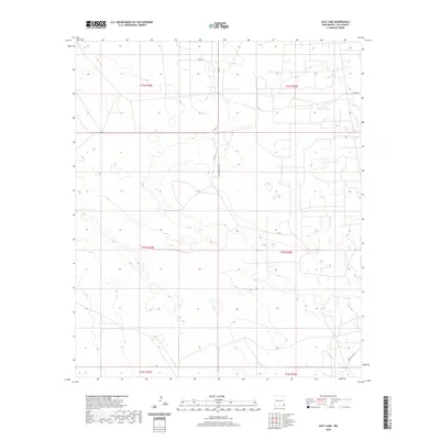
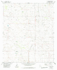
2020 Map of East Lake
USGS Topo · Published 2020About this map
The high desert terrain of Lea County is meticulously defined in this topographic study, where local transport routes provide the primary human imprint on an otherwise sparse landscape. Access through the region is anchored by Teague Switch Rd and Deep Wells Rd, names that reflect the industrial and ranching heritage of southeastern New Mexico. The map reveals a high-resolution view of the local drainage patterns and elevation changes, critical for understanding the land use within the township and range divisions of t23s r36e and t22s r35e. While major settlements are absent, the network of secondary routes like Co Rd 11 and Co Rd 21 suggests the persistent movement and utility required for resource management in this arid environment.
Find a feature on this map
11 named features on this map. Tap any name to fly to it.
Don’t see what you’re looking for? This feature index may not catch every label — zoom into the map to look around manually.
Map Details
Editions of this 2020 East Lake Map
This is the sole edition of this map. No revisions or reprints were ever made.
Other maps of this area

1954 · Hobbs
USGS Topo · 1:250,000

1958 · Hobbs
USGS Topo · 1:250,000
1963 · Oil Center
USGS Topo · 1:62,500
1969 · Eunice
USGS Topo · 1:24,000
1969 · Jal NW
USGS Topo · 1:24,000
1969 · Rattlesnake Canyon
USGS Topo · 1:24,000
1973 · Custer Mountain
USGS Topo · 1:24,000
1973 · Woodley Flat
USGS Topo · 1:24,000
1978 · Jal
USGS Topo · 1:100,000
1984 · Oil Center
USGS Topo · 1:24,000