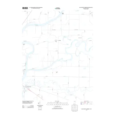
2013 Map of East Mount Carmel
USGS Topo · Published 2013About this map
The Wabash River and White River converge in this riverine landscape at the border of Indiana and Illinois. The settlement of East Mount Carmel sits near the southwestern corner, while the small community of Orrville is positioned further north, flanked by the Orrville Hills. The hydrology of the region is complex, defined by winding watercourses like the Patoka River and Coon Cr, alongside distinctive features such as Kellys Ripple and the Grand Rapids.
Find a feature on this map
69 named features on this map. Tap any name to fly to it.
Don’t see what you’re looking for? This feature index may not catch every label — zoom into the map to look around manually.
Map Details
Editions of this 2013 East Mount Carmel Map
This is the sole edition of this map. No revisions or reprints were ever made.
Other maps of this area

1901 · Princeton
USGS Topo · 1:62,500

1903 · Princeton
USGS Topo · 1:62,500

1903 · Patoka
USGS Topo · 1:125,000

1904 · Mount Carmel
USGS Topo · 1:62,500

1911 · Sumner
USGS Topo · 1:62,500

1913 · Sumner
USGS Topo · 1:62,500

1915 · Vincennes
USGS Topo · 1:62,500

1944 · Vincennes
USGS Topo · 1:62,500

1956 · Vincennes
USGS Topo · 1:250,000

1957 · Vincennes
USGS Topo · 1:250,000