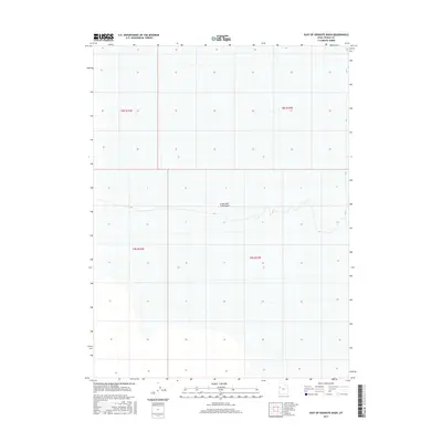
2017 Map of East of Goshute Wash
USGS Topo · Published 2017About this map
The Great Salt Lake Desert dominates this vast and desolate landscape within Tooele County, captured during a 2017 survey. The map depicts a region defined by extreme environmental conditions, where the salt crust of the Great Salt Lake Basin creates a nearly featureless expanse. The cartography is organized by the Public Land Survey System, specifically identifying portions of t8s r16w, t8s r15w, t9s r16w, and t9s r15w. These township and range boundaries provide the primary structure for navigating this remote desert floor, where traditional landmarks are replaced by the subtle topographical variations of the basin. The focus here is on the physical geography of the desert rather than human infrastructure, offering a clear record of the area's natural state in the early 21st century.
Find a feature on this map
5 named features on this map. Tap any name to fly to it.
Don’t see what you’re looking for? This feature index may not catch every label — zoom into the map to look around manually.
Map Details
Editions of this 2017 East of Goshute Wash Map
This is the sole edition of this map. No revisions or reprints were ever made.
Other maps of this area
1908 · Fish Springs
USGS Topo · 1:250,000
1910 · Fish Springs
USGS Topo · 1:250,000

1953 · Tooele
USGS Topo · 1:250,000

1953 · Delta
USGS Topo · 1:250,000

1955 · Tooele
USGS Topo · 1:250,000

1958 · Delta
USGS Topo · 1:250,000

1962 · Delta
USGS Topo · 1:250,000
1967 · Fish Springs NW
USGS Topo · 1:24,000
1973 · Gold Hill 4 SE
USGS Topo · 1:24,000
1973 · Granite Peak NW
USGS Topo · 1:24,000