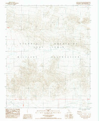
1984 Map of East of Leach Lake
USGS Topo · Published 1984About this map
The Avawatz Mountains dominate this high-desert terrain within the Fort Irwin Military Reservation. This 1984 provisional edition highlights a landscape shaped by topographic extremes and restricted military access in San Bernardino County. In the southern reaches of the quadrangle, Drinkwater Lake appears as a prominent hydrologic feature in an otherwise arid expanse. The map illustrates a network of 4wd tracks that serve as the primary means of navigating the complex slopes and valleys of the range, reflecting the area's use for tactical maneuvers and training during the late twentieth century. Surveyed between 1976 and 1981, this sheet documents the precise boundaries of the reservation as it stood before modern expansions.
Find a feature on this map
6 named features on this map. Tap any name to fly to it.
Don’t see what you’re looking for? This feature index may not catch every label — zoom into the map to look around manually.
Map Details
Editions of this 1984 East of Leach Lake Map
2 editions found
Other maps of this area

1933 · Avawatz Mountains
USGS Topo · 1:250,000

1947 · Trona
USGS Topo · 1:250,000

1948 · Red Pass Lake
USGS Topo · 1:62,500

1948 · Trona
USGS Topo · 1:250,000

1948 · Leach Lake
USGS Topo · 1:62,500

1948 · Avawatz Pass
USGS Topo · 1:62,500

1948 · Tiefort Mountains
USGS Topo · 1:62,500

1951 · Tiefort Mountains
USGS Topo · 1:62,500

1951 · Avawatz Pass
USGS Topo · 1:62,500

1951 · Red Pass Lake
USGS Topo · 1:62,500