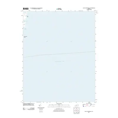
2011 Map of East of Reedville
USGS Topo · Published 2011About this map
Chesapeake Bay dominates this coastal survey, where the shoreline of Virginia's Northern Neck meets the open water. Small waterfront communities like Chesapeake Beach and Neals Beach are situated along the narrow strip of land between the bay and a series of inland water bodies. These tidal features, including Owens Pond, Gaskin Pond, and Rock Hole, characterize the delicate hydrology of the peninsula. The map reveals how local geography is shaped by these lagoons and ponds, which serve as natural buffers for the settlements along the coast. This study captures the littoral landscape at a specific moment in the early 21st century, illustrating the relationship between residential footprints and the aquatic environment of the bay.
Find a feature on this map
8 named features on this map. Tap any name to fly to it.
Don’t see what you’re looking for? This feature index may not catch every label — zoom into the map to look around manually.
Map Details
Editions of this 2011 East of Reedville Map
This is the sole edition of this map. No revisions or reprints were ever made.
Other maps of this area

1916 · Kilmarnock
USGS Topo · 1:48,000

1917 · Heathsville
USGS Topo · 1:48,000

1917 · Kilmarnock
USGS Topo · 1:62,500

1917 · Ewell
USGS Topo · 1:62,500

1942 · Kilmarnock
USGS Topo · 1:62,500

1942 · Ewell
USGS Topo · 1:24,000
1943 · Ewell
USGS Topo · 1:31,680

1943 · Richmond
USGS Topo · 1:250,000
1944 · Sunnybank
USGS Topo · 1:31,680

1944 · Reedville
USGS Topo · 1:31,680