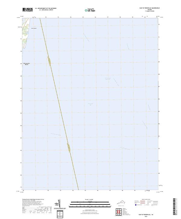
2022 Map of East of Reedville
USGS Topo · Published 2022About this map
The vast expanse of the Chesapeake Bay dominates this coastal survey, where the maritime borders of the Northern Neck meet the open water. Along the western shoreline, the small residential clusters of Neals Beach and Chesapeake Beach mark the land's edge, offering a look at modern coastal settlement patterns in Northumberland County. This map is primarily a study of hydrography and boundaries, tracing the invisible line between Accomack Co and Northumberland Co as it cuts across the water. Important navigational arteries converge here, including the Intracoastal Waterway and the mouths of the Little Wicomico River, the Great Wicomico River, and the Potomac River. The map provides a clear record of the shoreline and deep-water channels as they existed in the early 2020s, showing how these historic Virginia waterways continue to serve as essential corridors for transit and recreation.
Find a feature on this map
10 named features on this map. Tap any name to fly to it.
Don’t see what you’re looking for? This feature index may not catch every label — zoom into the map to look around manually.
Map Details
Editions of this 2022 East of Reedville Map
This is the sole edition of this map. No revisions or reprints were ever made.
Other maps of this area

1916 · Kilmarnock
USGS Topo · 1:48,000

1917 · Heathsville
USGS Topo · 1:48,000

1917 · Kilmarnock
USGS Topo · 1:62,500

1917 · Ewell
USGS Topo · 1:62,500

1942 · Kilmarnock
USGS Topo · 1:62,500

1942 · Ewell
USGS Topo · 1:24,000
1943 · Ewell
USGS Topo · 1:31,680

1943 · Richmond
USGS Topo · 1:250,000
1944 · Sunnybank
USGS Topo · 1:31,680

1944 · Reedville
USGS Topo · 1:31,680