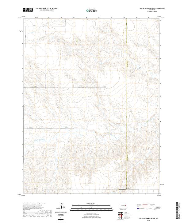
2022 Map of East of Sevenmile Ranch
USGS Topo · Published 2022About this map
The S Fork Republican River carves a winding path through the High Plains along the border of Lincoln and Kit Carson counties. This 2022 survey documents a largely open landscape defined by deep draws and drainage patterns, including the headwaters of Duck Cr in the northern sections. The area is gridded by a network of county roads such as Co Rd 45 and Co Rd 38, which follow the section lines established by the Public Land Survey System. The map shows the transition between Township 9 South and Township 10 South, illustrating the rural infrastructure that supports the ranching and agricultural operations east of Sevenmile Ranch.
Find a feature on this map
20 named features on this map. Tap any name to fly to it.
Don’t see what you’re looking for? This feature index may not catch every label — zoom into the map to look around manually.
Map Details
Editions of this 2022 East of Sevenmile Ranch Map
This is the sole edition of this map. No revisions or reprints were ever made.
Other maps of this area

1954 · Limon
USGS Topo · 1:250,000

1957 · Limon
USGS Topo · 1:250,000

1958 · Limon
USGS Topo · 1:250,000

1978 · Clifford
USGS Topo · 1:24,000

1978 · Hugo 4 NW
USGS Topo · 1:24,000

1979 · Sevenmile Ranch
USGS Topo · 1:24,000
1979 · Clifford
USGS Topo · 1:24,000

1979 · Hugo 4 NE
USGS Topo · 1:24,000

1979 · Arriba
USGS Topo · 1:24,000

1979 · Flagler SW
USGS Topo · 1:24,000