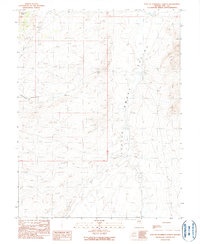
1990 Map of East of Snowball Ranch
USGS Topo · Published 1990About this map
Little Smoky Valley and the Fish Creek Range dominate this high-desert Nevada landscape, captured in a 1990 provisional study. The terrain is defined by a series of alluvial washes and canyons that drain eastward toward the valley floor, including Willow Creek, Cottonwood Cr, and Snowball Creek. A prominent Fault line runs through the southern portion of the sheet near Big Wash, illustrating the tectonic activity central to the region's geological character. Resource exploration is indicated by a solitary Prospect in the northwest, suggesting mineral interests typical of the Nye County backcountry. The map provides a look at the arid drainage patterns and structural geology before modern developments, showing a largely undisturbed basin-and-range environment where seasonal water flows have shaped the sandy valley bottom.
Find a feature on this map
12 named features on this map. Tap any name to fly to it.
Don’t see what you’re looking for? This feature index may not catch every label — zoom into the map to look around manually.
Map Details
Editions of this 1990 East of Snowball Ranch Map
This is the sole edition of this map. No revisions or reprints were ever made.
Other maps of this area

1926 · Roberts Mountains
USGS Topo · 1:250,000

1929 · Roberts Mountains
USGS Topo · 1:250,000

1955 · Millett
USGS Topo · 1:250,000

1956 · Cockalorum Wash
USGS Topo · 1:62,500

1956 · Lund
USGS Topo · 1:250,000

1956 · Ely
USGS Topo · 1:250,000

1956 · Tonopah
USGS Topo · 1:250,000

1959 · Ely
USGS Topo · 1:250,000

1959 · Tonopah
USGS Topo · 1:250,000

1959 · Millett
USGS Topo · 1:250,000