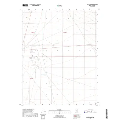
2018 Map of East of Tonopah
USGS Topo · Published 2018About this map
Tonopah Airport serves as a central hub in this high-desert region of Nye County, surrounded by a structured network of modern residential streets including Donnels Dr, Mustang Dr, and Scott Dr. The landscape is dominated by the broad, open expanse of the Ralston Desert, where elevation contours reveal a gentle slope toward the south. Major transportation corridors converge here, with Airport Rd and Airway Dr providing access to the airfield, while State Route 376 and Highway 6 facilitate travel across the basins and ranges of central Nevada. This 2018 survey illustrates the organized layout of the local infrastructure adjacent to the airfield, contrasting the planned street grids with the surrounding undisturbed desert terrain.
Find a feature on this map
14 named features on this map. Tap any name to fly to it.
Don’t see what you’re looking for? This feature index may not catch every label — zoom into the map to look around manually.
Map Details
Editions of this 2018 East of Tonopah Map
This is the sole edition of this map. No revisions or reprints were ever made.
Other maps of this area

1907 · Tonopah
USGS Topo · 1:250,000

1908 · Kawich
USGS Topo · 1:250,000

1908 · Lida
USGS Topo · 1:250,000

1908 · Tonopah
USGS Topo · 1:250,000

1913 · Lida
USGS Topo · 1:250,000

1942 · Cactus Range
USGS Topo · 1:125,000

1945 · Goldfield
USGS Topo · 1:125,000

1952 · Mud Lake
USGS Topo · 1:62,500

1952 · Cactus Peak
USGS Topo · 1:62,500

1954 · Goldfield
USGS Topo · 1:250,000