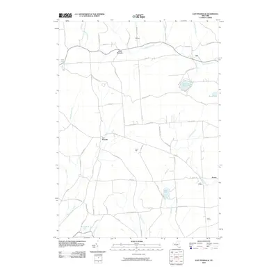
2010 Map of East Pharsalia
USGS Topo · Published 2010About this map
North Pharsalia and East Pharsalia anchor this Chenango County landscape, which is defined by high ridges and a complex network of headwater streams. The presence of the Old CCC Truck Trl and CCC Trk Trl signals the historical legacy of the Civilian Conservation Corps in managing these upland forests. At the center of the quadrangle, Berry Hill rises above the surrounding valleys of Canasawacta Creek and Genegantslet Creek. Genealogists will find interest in several family and community burial sites, including the Frink Cemetery in the north and the Rogers Cemetery near the eastern boundary. The map also records the recreational and utility value of local waters, from the prominent Plymouth Reservoir and its associated Reservoir Hill Rd to smaller, quiet water bodies like Steer Pond and Deer Pond.
Find a feature on this map
67 named features on this map. Tap any name to fly to it.
Don’t see what you’re looking for? This feature index may not catch every label — zoom into the map to look around manually.
Map Details
Editions of this 2010 East Pharsalia Map
This is the sole edition of this map. No revisions or reprints were ever made.
Other maps of this area

1902 · Coventry
USGS Topo · 1:62,500

1903 · Norwich
USGS Topo · 1:62,500

1904 · Greene
USGS Topo · 1:62,500

1904 · Oxford
USGS Topo · 1:62,500

1904 · Pitcher
USGS Topo · 1:62,500

1943 · Otselic
USGS Topo · 1:24,000

1943 · South Ostelic
USGS Topo · 1:24,000

1943 · Norwich
USGS Topo · 1:24,000

1943 · East Pharsalia
USGS Topo · 1:24,000
1943 · Earlville
USGS Topo · 1:24,000