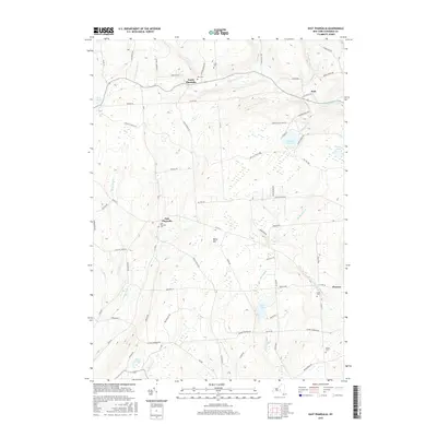
2016 Map of East Pharsalia
USGS Topo · Published 2016About this map
North Pharsalia and East Pharsalia anchor this portion of Chenango County, characterized by high elevations and a dense network of mountain streams. The terrain rises to Berry Hill, while several small burial grounds including East Pharsalia Cem and Kirk Cem are preserved along the winding local roads. A reliance on water resources is evident through the presence of the Plymouth Reservoir and numerous ponds like Steer Pond and Bliven Pond. The map reveals a remote landscape where transportation is defined by legacy routes such as Old State Rte 23 and various forest tracks including the CCC Trx Trl. These corridors connect the small hamlets of Kirk and Preston while following natural drainage patterns established by Canasawacta Cr and Genegantslet Cr.
Find a feature on this map
76 named features on this map. Tap any name to fly to it.
Don’t see what you’re looking for? This feature index may not catch every label — zoom into the map to look around manually.
Map Details
Editions of this 2016 East Pharsalia Map
This is the sole edition of this map. No revisions or reprints were ever made.
Other maps of this area

1902 · Coventry
USGS Topo · 1:62,500

1903 · Norwich
USGS Topo · 1:62,500

1904 · Greene
USGS Topo · 1:62,500

1904 · Oxford
USGS Topo · 1:62,500

1904 · Pitcher
USGS Topo · 1:62,500

1943 · Otselic
USGS Topo · 1:24,000

1943 · South Ostelic
USGS Topo · 1:24,000

1943 · Norwich
USGS Topo · 1:24,000

1943 · East Pharsalia
USGS Topo · 1:24,000
1943 · Earlville
USGS Topo · 1:24,000