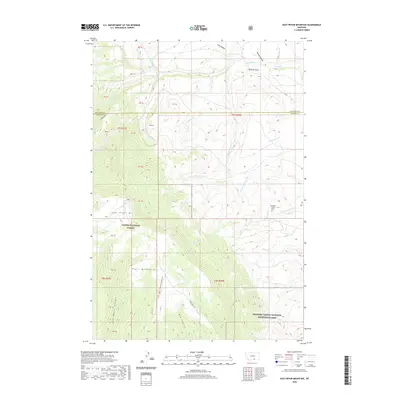
2020 Map of East Pryor Mountain
USGS Topo · Published 2020About this map
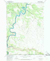
East Pryor Mtn and the surrounding Pryor Mountains define this high-elevation landscape along the border of Carbon and Big Horn counties. This modern topographic study reveals a terrain marked by deep drainage systems like Lost Water Canyon and extensive coulees, including Big Coulee and Rotten Coulee. The map details significant cultural and archaeological markers, such as the Buffalo Jump near Dry Head Cr and the isolated Deadman Creek Grave near the eastern boundary. The area is divided between the Custer National Forest and the Bighorn Canyon National Recreation Area, with access provided by primitive routes such as Sykes Ridge Rd and Burnt Timber-Tillet Ridge Rd. Numerous springs and creeks, including Red Spring Cr and Big Spring, suggest the vital water sources that have supported human activity in these uplands for generations.
Find a feature on this map
32 named features on this map. Tap any name to fly to it.
Don’t see what you’re looking for? This feature index may not catch every label — zoom into the map to look around manually.
Map Details
Editions of this 2020 East Pryor Mountain Map
This is the sole edition of this map. No revisions or reprints were ever made.
Other maps of this area

1954 · Billings
USGS Topo · 1:250,000

1957 · Billings
USGS Topo · 1:250,000

1958 · Billings
USGS Topo · 1:250,000

1964 · Big Ice Cave
USGS Topo · 1:24,000

1964 · Red Pryor Mountain
USGS Topo · 1:24,000
1964 · Horse Coulee
USGS Topo · 1:24,000
1964 · Dead Indian Hill
USGS Topo · 1:24,000

1964 · East Pryor Mountain
USGS Topo · 1:24,000
1964 · Mystery Cave
USGS Topo · 1:24,000
1964 · Hillsboro
USGS Topo · 1:24,000