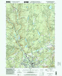
1999 Map of East Stroudsburg
USGS Topo · Published 2002About this map
Brodhead Creek carves a deep valley through the southern foothills of the Poconos, anchoring a landscape where historical infrastructure meets mid-century recreation. This survey shows the dense residential core of East Stroudsburg and Gravel Place tucked between the Erie Lackawanna RR and the rugged slopes of Pocono Mountain. The presence of numerous upland water bodies like Pocohontas Lake, Lake Valhalla, and Lake Monroe indicates a region shaped by seasonal tourism and conservation, with significant acreage dedicated to the Delaware State Forest.
Find a feature on this map
71 named features on this map. Tap any name to fly to it.
Don’t see what you’re looking for? This feature index may not catch every label — zoom into the map to look around manually.
Map Details
Editions of this 1999 East Stroudsburg Map
This is the sole edition of this map. No revisions or reprints were ever made.
Other maps of this area

1891 · Delaware Water Gap
USGS Topo · 1:62,500

1893 · Delaware Water Gap
USGS Topo · 1:62,500

1914 · Wind Gap
USGS Topo · 1:62,500

1916 · Wind Gap
USGS Topo · 1:62,500

1919 · Pocono
USGS Topo · 1:62,500

1921 · Pocono
USGS Topo · 1:62,500

1923 · Pocono
USGS Topo · 1:62,500

1924 · Bushkill
USGS Topo · 1:48,000

1936 · Delaware Water Gap
USGS Topo · 1:48,000

1941 · Delaware Water Gap
USGS Topo · 1:62,500
Featured Places
- Paradise Township, PA
- Analomink, Stroud Township
- Marshalls Creek, Smithfield Township
- Middle Smithfield Township, PA
- Arlington Heights, Stroud Township