
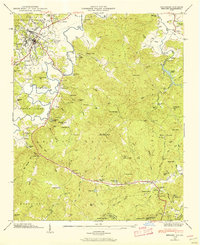
1935 Map of Eastatoe Gap
USGS Topo · Published 1935About this map
Middle Fork Ch stands as a focal point for the mountain communities along the Blue Ridge crest in the mid-1930s. The Tennessee Valley Authority and U.S. Geological Survey collaborated on this study of the borderlands between North Carolina and South Carolina, where the headwaters of the East Fork French Broad River and Middle Fork French Broad River carve through high-elevation terrain. The map traces the winding route of State Highway No 283 as it follows the river valley beneath Joshua Mtn. Landmarks like Ellicott Rock mark the historic intersection of state lines, while the Fire Tower atop Sassafras Mtn indicates the area's importance for forest management and observation during this period. Local geography is defined by a series of gaps, including Eastatoe Gap and Blue Ridge Gap, which served as traditional passage points through the ridge line.
Find a feature on this map
34 named features on this map. Tap any name to fly to it.
Don’t see what you’re looking for? This feature index may not catch every label — zoom into the map to look around manually.
Map Details
Editions of this 1935 Eastatoe Gap Map
This is the sole edition of this map. No revisions or reprints were ever made.
Other maps of this area

1888 · Pickens
USGS Topo · 1:125,000

1894 · Pickens
USGS Topo · 1:125,000

1905 · Pisgah
USGS Topo · 1:125,000

1906 · Pisgah
USGS Topo · 1:125,000

1935 · Brevard
USGS Topo · 1:24,000

1935 · Rosman
USGS Topo · 1:24,000

1935 · Lake Toxaway
USGS Topo · 1:24,000

1935 · Reid
USGS Topo · 1:24,000

1935 · Table Rock
USGS Topo · 1:24,000
1945 · Brevard
USGS Topo · 1:24,000