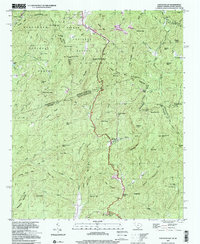
1997 Map of Eastatoe Gap
USGS Topo · Published 2001About this map
Moorefield Memorial Highway winds through the high-elevation terrain of this 1997 photo-inspected survey, which captures a landscape defined by the Tennessee Valley Authority’s 1946 field checks. The map highlights the intersection of transportation and mountain topography, notably where the Blue Ridge Parkway traverses the ridges. This edition reflects the area's mid-century development patterns, showing the placement of rural outposts like Camp Adger and the high-peak settlement of Chimneytop. The presence of Nancy Mtn and other family-named landmarks provides a valuable look at the geographic character of Transylvania County as it transitioned toward the 21st century while retaining its historic infrastructure.
Find a feature on this map
5 named features on this map. Tap any name to fly to it.
Don’t see what you’re looking for? This feature index may not catch every label — zoom into the map to look around manually.
Map Details
Editions of this 1997 Eastatoe Gap Map
This is the sole edition of this map. No revisions or reprints were ever made.
Other maps of this area

1888 · Pickens
USGS Topo · 1:125,000

1894 · Pickens
USGS Topo · 1:125,000

1905 · Pisgah
USGS Topo · 1:125,000

1906 · Pisgah
USGS Topo · 1:125,000

1935 · Brevard
USGS Topo · 1:24,000

1935 · Eastatoe Gap
USGS Topo · 1:24,000

1935 · Rosman
USGS Topo · 1:24,000

1935 · Lake Toxaway
USGS Topo · 1:24,000

1935 · Reid
USGS Topo · 1:24,000

1935 · Table Rock
USGS Topo · 1:24,000