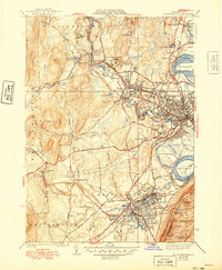
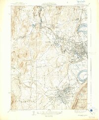
1939 Map of Easthampton
USGS Topo · Published 1949About this map
Northampton serves as the industrial and educational anchor of the Pioneer Valley during this mid-century period, centered on the prestigious grounds of Smith College and the expansive Look Memorial Park. The landscape reveals a complex network of institutional and civic sites, including the County Sanatorium near Leeds and the U S Veterans Hospital situated north of Florence. Industry and water management are intertwined along the Mill River, while the southern reaches are dominated by the manufacturing center of Easthampton, home to Williston Academy and the adjacent Nashawannuck Pond.
Find a feature on this map
100 named features on this map. Tap any name to fly to it.
Don’t see what you’re looking for? This feature index may not catch every label — zoom into the map to look around manually.
Map Details
Editions of this 1939 Easthampton Map
5 editions found
Other maps of this area

1885 · Northampton
USGS Topo · 1:62,500

1886 · Springfield
USGS Topo · 1:62,500

1886 · Chesterfield
USGS Topo · 1:62,500

1886 · Northampton
USGS Topo · 1:62,500

1887 · Granville
USGS Topo · 1:62,500

1888 · Chesterfield
USGS Topo · 1:62,500

1889 · Springfield
USGS Topo · 1:62,500

1889 · Granville
USGS Topo · 1:62,500

1891 · Northampton
USGS Topo · 1:62,500

1893 · Northampton
USGS Topo · 1:62,500