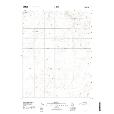
2020 Map of Eastland NW
USGS Topo · Published 2020About this map
Hickman Flat dominates the central landscape of this San Juan County region, illustrating the high-plateau topography characteristic of southeast Utah. The 2020 terrain is marked by a sophisticated network of rural access routes, including Houston Rd, Old Summit Rd, and Farmer Rd, which serve the agricultural and ranching interests of the area. Water management is a primary feature of the local geography, centered around Iron Springs Reservoir and the drainage of Boulder Cr.
Find a feature on this map
20 named features on this map. Tap any name to fly to it.
Don’t see what you’re looking for? This feature index may not catch every label — zoom into the map to look around manually.
Map Details
Editions of this 2020 Eastland NW Map
This is the sole edition of this map. No revisions or reprints were ever made.
Other maps of this area

1885 · La Sal
USGS Topo · 1:250,000

1886 · Abajo
USGS Topo · 1:250,000

1892 · Abajo
USGS Topo · 1:250,000

1893 · Abajo
USGS Topo · 1:250,000

1954 · Mt Peale 3 SE
USGS Topo · 1:24,000
1954 · Mt Peale 4 SE
USGS Topo · 1:24,000

1954 · Mt Peale 4 SW
USGS Topo · 1:24,000
1954 · Lisbon Valley
USGS Topo · 1:62,500
1954 · Hatch Rock
USGS Topo · 1:62,500

1955 · Verdure 2 SE
USGS Topo · 1:24,000