
1950 Map of Easton
USGS Topo · Published 1950About this map
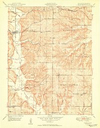
Stranger Creek winds through the heart of this landscape, anchoring a network of tributaries that defined the rural layout of western Leavenworth County in the late 1940s. The settlement of Easton serves as a primary hub, while the smaller community of Springdale to the south is marked by the Springdale School and Quaker Church. The territory is divided between the townships of Easton, Kickapoo, Alexandria, and High Prairie, reflecting a dense agrarian development pattern where neighborhood schools and churches were the lifeblood of the community. Genealogists will find a wealth of local landmarks, from the Eightmile House in the north to the Gospel Tabernacle along the Perryville Road in the south. The Santa Fe railroad corridor cuts across the northern tier, connecting these remote townships to the broader regional economy.
Find a feature on this map
32 named features on this map. Tap any name to fly to it.
Don’t see what you’re looking for? This feature index may not catch every label — zoom into the map to look around manually.
Map Details
Editions of this 1950 Easton Map
2 editions found
Other maps of this area

1886 · Oskaloosa
USGS Topo · 1:125,000

1888 · Oskaloosa
USGS Topo · 1:125,000

1890 · Kansas City
USGS Topo · 1:125,000

1894 · Kansas City
USGS Topo · 1:125,000

1894 · Oskaloosa
USGS Topo · 1:125,000

1910 · Leavenworth
USGS Topo · 1:62,500

1934 · Bonner Springs
USGS Topo · 1:48,000

1940 · Bonner Springs
USGS Topo · 1:62,500

1948 · Oak Mills
USGS Topo · 1:24,000

1948 · Leavenworth
USGS Topo · 1:62,500