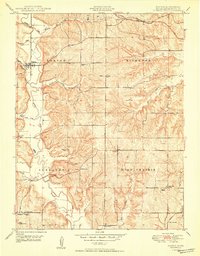
1950 Map of Easton
USGS Topo · Published 1950About this map
The town of Easton sits at a critical junction in Leavenworth County, situated where the Union Pacific railroad tracks cross the winding path of Stranger Creek. This 1950 survey reveals a landscape of dispersed rural communities across the townships of Easton, Kickapoo, Alexandria, and High Prairie. The area is characterized by a dense network of one-room schools and country churches that anchored early Kansas life, including the Grandview School and St Joseph Church in the north, and the Springdale School to the south.
Find a feature on this map
31 named features on this map. Tap any name to fly to it.
Don’t see what you’re looking for? This feature index may not catch every label — zoom into the map to look around manually.
Map Details
Editions of this 1950 Easton Map
2 editions found

Other maps of this area

1886 · Oskaloosa
USGS Topo · 1:125,000

1888 · Oskaloosa
USGS Topo · 1:125,000

1890 · Kansas City
USGS Topo · 1:125,000

1894 · Kansas City
USGS Topo · 1:125,000

1894 · Oskaloosa
USGS Topo · 1:125,000

1910 · Leavenworth
USGS Topo · 1:62,500

1934 · Bonner Springs
USGS Topo · 1:48,000

1940 · Bonner Springs
USGS Topo · 1:62,500

1948 · Oak Mills
USGS Topo · 1:24,000

1948 · Leavenworth
USGS Topo · 1:62,500