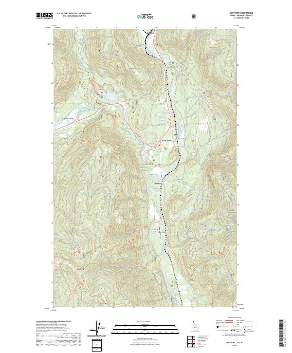
2024 Map of Eastport
USGS Topo · Published 2024About this map
The Moyie River carves a deep path through this portion of the Kaniksu National Forest, serving as the primary corridor for human settlement and transport in the northern Idaho panhandle. Along its banks, the small communities of Eastport, Addie, and the uniquely named Good Grief are situated near US Hwy 95, reflecting the historical reliance on this river valley for passage through the mountains. To the west and east, the terrain rises sharply into the Purcell Mountains and toward peaks like Border Mtn and Hogue Mtn.
Find a feature on this map
45 named features on this map. Tap any name to fly to it.
Don’t see what you’re looking for? This feature index may not catch every label — zoom into the map to look around manually.
Map Details
Editions of this 2024 Eastport Map
This is the sole edition of this map. No revisions or reprints were ever made.
Other maps of this area

1911 · Priest Lake
USGS Topo · 1:250,000

1913 · Priest Lake
USGS Topo · 1:250,000

1958 · Sandpoint
USGS Topo · 1:250,000

1963 · Sandpoint
USGS Topo · 1:250,000

1965 · Meadow Creek
USGS Topo · 1:24,000

1965 · Eastport
USGS Topo · 1:24,000

1965 · Ritz
USGS Topo · 1:24,000
1965 · Line Point
USGS Topo · 1:24,000
1965 · Canuck Peak
USGS Topo · 1:24,000

1965 · Hall Mountain
USGS Topo · 1:24,000