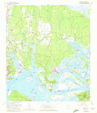
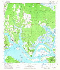
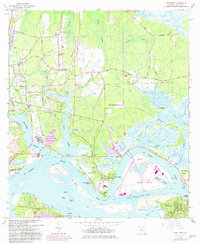
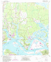
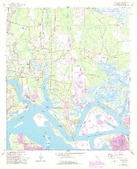
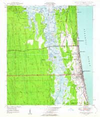
1964 Map of Eastport
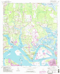
USGS Topo · Published 1972About this map
The St Johns River dominates this mid-century survey of Duval County, where the industrial expansion of the Eastport waterfront meets the sprawling wetlands of Caney Swamp and Clapboard Swamp. The landscape reveals a complex network of coastal islands and tidal flats, including the significant landmass of Blount Island and the smaller Alligator Island. Residential clusters such as Polly Town and Dame Point Manor are shown alongside established historical sites like Yellow Bluff Fort and the commemorative landmark of Ft Caroline.
Find a feature on this map
73 named features on this map. Tap any name to fly to it.
Don’t see what you’re looking for? This feature index may not catch every label — zoom into the map to look around manually.
Map Details
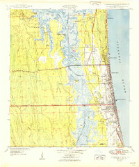
Editions of this 1964 Eastport Map
7 editions found

Other maps of this area

1918 · St Marys
USGS Topo · 1:62,500

1918 · Jacksonville
USGS Topo · 1:62,500
1918 · Mayport
USGS Topo · 1:62,500
1919 · Fernandina
USGS Topo · 1:62,500

1919 · St Marys
USGS Topo · 1:62,500

1944 · Fernandina
USGS Topo · 1:62,500

1948 · Jacksonville
USGS Topo · 1:250,000
1948 · Jacksonville Beach
USGS Topo · 1:24,000

1948 · Eastport
USGS Topo · 1:24,000
1949 · Jacksonville Beach
USGS Topo · 1:24,000
Featured Places
- Jacksonville, FL
- New Berlin, Jacksonville
- Fort Caroline, Jacksonville
- Polly Town, Jacksonville
- Dames Point Manor, Jacksonville