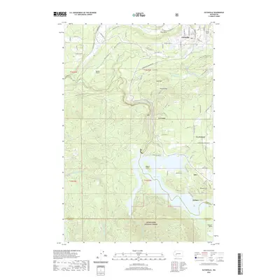
2020 Map of Eatonville
USGS Topo · Published 2020About this map
The town of Eatonville serves as the primary hub in this Pierce County landscape, situated near the confluence where Ohop Cr meets the Mashel River. The surrounding geography is defined by a series of plateaus and steep river valleys, including the broad Mashel Prairie and the deep cut of the Nisqually River. To the south, the terrain descends toward the extensive waters of Alder Lake, where Bogucki Island sits near the shorelines of the Alder and La Grande communities.
Find a feature on this map
66 named features on this map. Tap any name to fly to it.
Don’t see what you’re looking for? This feature index may not catch every label — zoom into the map to look around manually.
Map Details
Editions of this 2020 Eatonville Map
This is the sole edition of this map. No revisions or reprints were ever made.
Other maps of this area

1937 · Eatonville
USGS Topo · 1:125,000

1941 · Tanwax Lake
USGS Topo · 1:62,500

1944 · Ohop Valley
USGS Topo · 1:62,500

1949 · Ohop Valley
USGS Topo · 1:62,500

1953 · Hoquiam
USGS Topo · 1:250,000

1956 · Mineral
USGS Topo · 1:62,500

1956 · Kapowsin
USGS Topo · 1:62,500

1957 · Hoquiam
USGS Topo · 1:250,000

1957 · Morton
USGS Topo · 1:62,500

1958 · Hoquiam
USGS Topo · 1:250,000