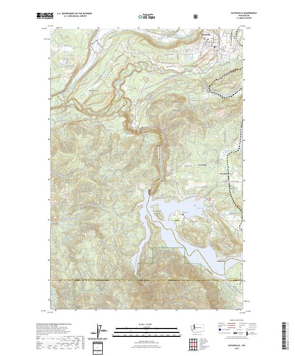
2023 Map of Eatonville
USGS Topo · Published 2023About this map
Eatonville stands at a topographical crossroads where the Ohop Valley and Mashel Prairie meet the rising foothills of the Snoqualmie National Forest. This modern record reveals a landscape shaped by timber and water, notably at the Eatonville Mill Pond and the extensive waters of Alder Lake to the south. The terrain is marked by significant elevation changes, from the depths of the Nisqually River canyon to the heights of Hugo Peak and Reliance Hill.
Find a feature on this map
69 named features on this map. Tap any name to fly to it.
Don’t see what you’re looking for? This feature index may not catch every label — zoom into the map to look around manually.
Map Details
Editions of this 2023 Eatonville Map
This is the sole edition of this map. No revisions or reprints were ever made.
Other maps of this area

1937 · Eatonville
USGS Topo · 1:125,000

1941 · Tanwax Lake
USGS Topo · 1:62,500

1944 · Ohop Valley
USGS Topo · 1:62,500

1949 · Ohop Valley
USGS Topo · 1:62,500

1953 · Hoquiam
USGS Topo · 1:250,000

1956 · Mineral
USGS Topo · 1:62,500

1956 · Kapowsin
USGS Topo · 1:62,500

1957 · Hoquiam
USGS Topo · 1:250,000

1957 · Morton
USGS Topo · 1:62,500

1958 · Hoquiam
USGS Topo · 1:250,000