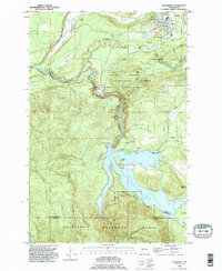
1990 Map of Eatonville
USGS Topo · Published 1995About this map
The town of Eatonville serves as the gateway to a landscape shaped by both forest research and hydro-electric power during the 1990s. This survey highlights the Charles Lathrop Pack Experimental Forest, a dedicated research area managed by the University of Washington, which occupies the central timberlands between the Nisqually River and Mashel River. To the south, the impact of the Alder Dam is evident, creating the expansive Alder Lake which straddles the borders of Pierce, Thurston, and Lewis counties.
Find a feature on this map
47 named features on this map. Tap any name to fly to it.
Don’t see what you’re looking for? This feature index may not catch every label — zoom into the map to look around manually.
Map Details
Editions of this 1990 Eatonville Map
This is the sole edition of this map. No revisions or reprints were ever made.
Other maps of this area

1937 · Eatonville
USGS Topo · 1:125,000

1941 · Tanwax Lake
USGS Topo · 1:62,500

1944 · Ohop Valley
USGS Topo · 1:62,500

1949 · Ohop Valley
USGS Topo · 1:62,500

1953 · Hoquiam
USGS Topo · 1:250,000

1956 · Mineral
USGS Topo · 1:62,500

1956 · Kapowsin
USGS Topo · 1:62,500

1957 · Hoquiam
USGS Topo · 1:250,000

1957 · Morton
USGS Topo · 1:62,500

1958 · Hoquiam
USGS Topo · 1:250,000