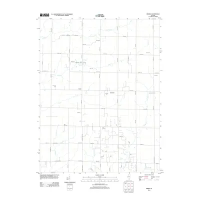
2012 Map of Eberle
USGS Topo · Published 2012About this map
Eberle serves as the central node of this agricultural landscape in southeastern Illinois, where the grid of rural roads is punctuated by an exceptional concentration of family and parish burial grounds. The cultural history of the township is legible through these sites, ranging from the Saint Matthew Lutheran Cem and Mount Zion Cem to smaller plots like Poe Cem and Scott Cem. These locations, often situated near farmsteads like the Zimdars Farm and Holste Brothers Farm, reflect the deep-rooted genealogical ties of the local community.
Find a feature on this map
67 named features on this map. Tap any name to fly to it.
Don’t see what you’re looking for? This feature index may not catch every label — zoom into the map to look around manually.
Map Details
Editions of this 2012 Eberle Map
This is the sole edition of this map. No revisions or reprints were ever made.
Other maps of this area

1950 · Effingham
USGS Topo · 1:62,500

1951 · Effingham
USGS Topo · 1:62,500

1953 · Teutopolis
USGS Topo · 1:62,500

1953 · Sailor Springs
USGS Topo · 1:62,500

1956 · Edgewood
USGS Topo · 1:62,500

1958 · Decatur
USGS Topo · 1:250,000

1958 · Belleville
USGS Topo · 1:250,000

1961 · Decatur
USGS Topo · 1:250,000

1962 · Belleville
USGS Topo · 1:250,000
1985 · Latona
USGS Topo · 1:24,000