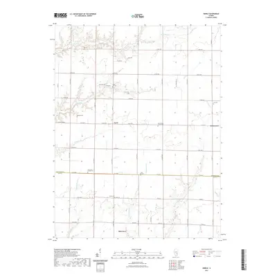
2021 Map of Eberle
USGS Topo · Published 2021About this map
The boundary between Effingham Co and Clay Co bisects this rural landscape, where the small community of Eberle serves as a central hub for the surrounding agricultural lands. The terrain is defined by a dense network of creek systems, including Little Muddy Cr, Panther Cr, and Georgetown Cr, which carve through the tillable acreage and influence the layout of local roads like Athens Ln and Shiloh Dr. To the south, the settlement of Bible Grove marks the lower reaches of the quadrangle.
Find a feature on this map
39 named features on this map. Tap any name to fly to it.
Don’t see what you’re looking for? This feature index may not catch every label — zoom into the map to look around manually.
Map Details
Editions of this 2021 Eberle Map
This is the sole edition of this map. No revisions or reprints were ever made.
Other maps of this area

1950 · Effingham
USGS Topo · 1:62,500

1951 · Effingham
USGS Topo · 1:62,500

1953 · Teutopolis
USGS Topo · 1:62,500

1953 · Sailor Springs
USGS Topo · 1:62,500

1956 · Edgewood
USGS Topo · 1:62,500

1958 · Decatur
USGS Topo · 1:250,000

1958 · Belleville
USGS Topo · 1:250,000

1961 · Decatur
USGS Topo · 1:250,000

1962 · Belleville
USGS Topo · 1:250,000
1985 · Latona
USGS Topo · 1:24,000