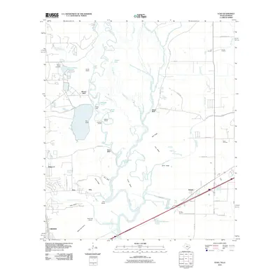
2010 Map of Echo
USGS Topo · Published 2010About this map
The Sabine River snakes through the borderlands between Texas and Louisiana, defining a landscape of complex waterways and alluvial ridges. At the southern edge of the survey, the city of Orange sits near the Blue Elbow and Lake Bienvenu, where the river splits into various channels and bayous. The industrial influence of the early 21st century is evident at the Owens-Illinois Reservoir and its associated dam. In Louisiana, the settlement of Toomey and landmarks like Niblett Bluff rise above the surrounding wetlands, including Gum Slough and Dynamite Slough. This region's history is tied to the management of these shifting waters, seen in the many named ridges like Beef Ridge and Bone Ridge that provided stable ground amidst the Little Cypress Bayou and Brenam Bayou systems.
Find a feature on this map
71 named features on this map. Tap any name to fly to it.
Don’t see what you’re looking for? This feature index may not catch every label — zoom into the map to look around manually.
Map Details
Editions of this 2010 Echo Map
This is the sole edition of this map. No revisions or reprints were ever made.
Other maps of this area

1926 · Mauriceville
USGS Topo · 1:24,000

1932 · Orange
USGS Topo · 1:62,500

1943 · Orangefield
USGS Topo · 1:24,000

1943 · Mauriceville
USGS Topo · 1:24,000

1946 · Phoenix Lake
USGS Topo · 1:31,680

1947 · Starks
USGS Topo · 1:31,680

1947 · Vinton
USGS Topo · 1:31,680

1947 · Toomey
USGS Topo · 1:31,680

1947 · Lunita
USGS Topo · 1:31,680
1949 · Cameron Farms
USGS Topo · 1:31,680