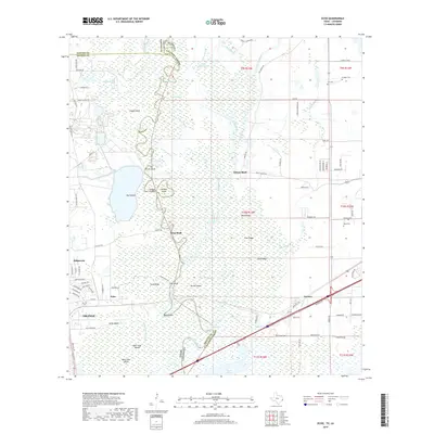
2019 Map of Echo
USGS Topo · Published 2019About this map
The Sabine River carves a winding path through the borderlands between Texas and Louisiana, defining a landscape of dense bayous, sloughs, and low-lying ridges. The settlement of Echo sits near the river's edge in Orange County, while Toomey and Niblett Bluff occupy the Louisiana side in Calcasieu Parish. This 2019 survey documents a complex hydrological network where land and water merge at Blue Elbow and Tupelo Swamp. Numerous family-named landmarks and small burial grounds like Lee Cem and Comier Cem provide valuable points of reference for genealogists tracing local families in this riverine environment. The presence of features such as Jackson Island and Pruitt Bluff highlights the historical importance of the river as both a boundary and a corridor for transport and settlement.
Find a feature on this map
109 named features on this map. Tap any name to fly to it.
Don’t see what you’re looking for? This feature index may not catch every label — zoom into the map to look around manually.
Map Details
Editions of this 2019 Echo Map
This is the sole edition of this map. No revisions or reprints were ever made.
Other maps of this area

1926 · Mauriceville
USGS Topo · 1:24,000

1932 · Orange
USGS Topo · 1:62,500

1943 · Orangefield
USGS Topo · 1:24,000

1943 · Mauriceville
USGS Topo · 1:24,000

1946 · Phoenix Lake
USGS Topo · 1:31,680

1947 · Starks
USGS Topo · 1:31,680

1947 · Vinton
USGS Topo · 1:31,680

1947 · Toomey
USGS Topo · 1:31,680

1947 · Lunita
USGS Topo · 1:31,680
1949 · Cameron Farms
USGS Topo · 1:31,680