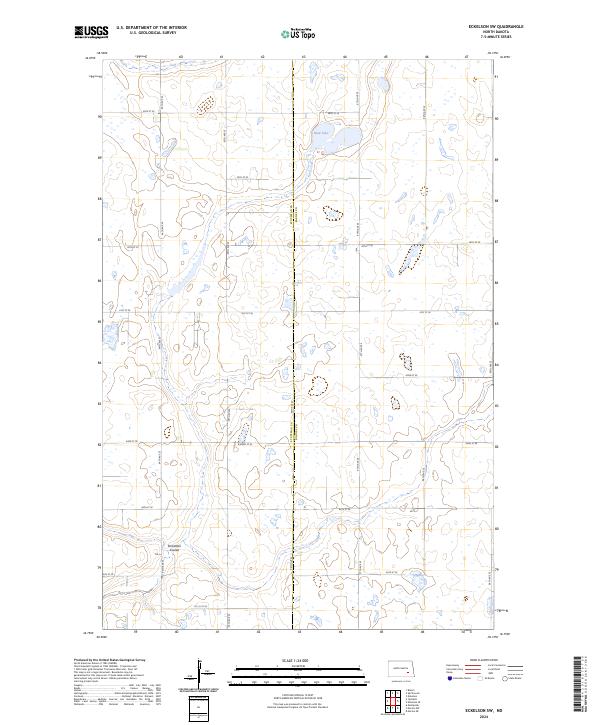
2024 Map of Eckelson SW
USGS Topo · Published 2024About this map
Glacial prairie potholes and undulating terrain define this section of the Dakotas along the Stutsman Co Barnes Co line. Central to the landscape is the Barnes County Waterfowl Production Area, a protected habitat surrounding the wetlands of Mud Lake. This area of the Missouri Coteau is characterized by a high density of small water bodies and seasonal wetlands, reflecting the post-glacial topography of the region. The map reveals a strictly organized section-line road network, including routes like 38th St SE and 96th Ave SE, which navigate around natural drainage features like Streaman Coulee. This layout illustrates the intersection of early twentieth-century agricultural land division with the natural hydrology of the Great Plains, where modern conservation efforts now manage the remaining native prairie and wetland complexes.
Find a feature on this map
23 named features on this map. Tap any name to fly to it.
Don’t see what you’re looking for? This feature index may not catch every label — zoom into the map to look around manually.
Map Details
Editions of this 2024 Eckelson SW Map
This is the sole edition of this map. No revisions or reprints were ever made.
Other maps of this area

1896 · Jamestown
USGS Topo · 1:125,000

1897 · Eckelson
USGS Topo · 1:125,000

1952 · Ypsilanti
USGS Topo · 1:24,000

1952 · Bloom
USGS Topo · 1:24,000

1953 · Jamestown
USGS Topo · 1:250,000

1953 · Montpelier
USGS Topo · 1:24,000

1956 · Jamestown
USGS Topo · 1:250,000

1970 · Eckelson
USGS Topo · 1:24,000
1970 · Spiritwood
USGS Topo · 1:24,000

1970 · Marion NE
USGS Topo · 1:24,000