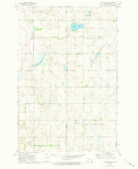
1970 Map of Eckelson SW
USGS Topo · Published 1973About this map
Glacial prairie potholes and low-lying wetlands dominate the border of Stutsman and Barnes counties in the early 1970s. The landscape is defined by the transition between several townships, including Winfield, Mansfield, Ypsilanti, and Meadow Lake. These jurisdictional boundaries cut across a terrain shaped by water and extraction, where numerous Gravel Pits suggest a local economy tied to road building and aggregate materials.
Find a feature on this map
12 named features on this map. Tap any name to fly to it.
Don’t see what you’re looking for? This feature index may not catch every label — zoom into the map to look around manually.
Map Details
Editions of this 1970 Eckelson SW Map
This is the sole edition of this map. No revisions or reprints were ever made.
Other maps of this area

1896 · Jamestown
USGS Topo · 1:125,000

1897 · Eckelson
USGS Topo · 1:125,000

1952 · Ypsilanti
USGS Topo · 1:24,000

1952 · Bloom
USGS Topo · 1:24,000

1953 · Jamestown
USGS Topo · 1:250,000

1953 · Montpelier
USGS Topo · 1:24,000

1956 · Jamestown
USGS Topo · 1:250,000

1970 · Eckelson
USGS Topo · 1:24,000
1970 · Spiritwood
USGS Topo · 1:24,000

1970 · Marion NE
USGS Topo · 1:24,000