
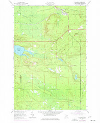
1951 Map of Eckerman
USGS Topo · Published 1955About this map
The Duluth South Shore and Atlantic Railroad cuts across this northern Michigan landscape, anchoring the small community of Eckerman and nearby Eckerman Corner. This early 1950s survey captures a wilderness transitional zone where logging-era infrastructure meets mid-century recreation and conservation. The presence of several private sporting camps, such as the No Dog Hunting Club and Petersburg Club, alongside the Eckerman Corner Lookout Tower and a Fish Hatchery, illustrates the area's dual role as a managed forest and a destination for outdoorsmen.
Find a feature on this map
28 named features on this map. Tap any name to fly to it.
Don’t see what you’re looking for? This feature index may not catch every label — zoom into the map to look around manually.
Map Details
Editions of this 1951 Eckerman Map
2 editions found
Other maps of this area

1931 · Epoufette NE
USGS Topo · 1:31,680

1931 · Epoufette NW
USGS Topo · 1:31,680

1941 · Strongs
USGS Topo · 1:63,360

1951 · Strongs
USGS Topo · 1:24,000

1951 · McNearney Lake
USGS Topo · 1:24,000

1951 · Piatt Lake
USGS Topo · 1:24,000

1951 · Big Beaver Creek
USGS Topo · 1:24,000

1951 · Hulbert
USGS Topo · 1:24,000

1951 · Strongs
USGS Topo · 1:62,500

1951 · Eckerman
USGS Topo · 1:62,500