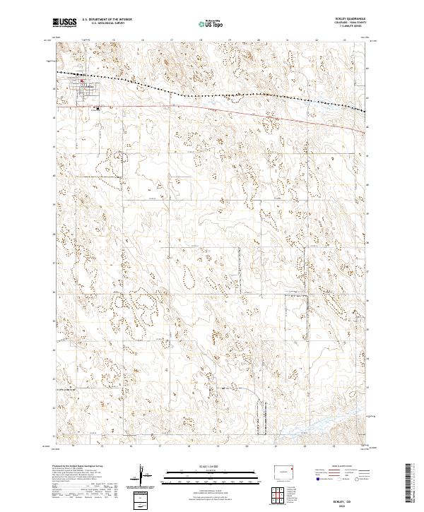
2022 Map of Eckley
USGS Topo · Published 2022About this map
Eckley sits as the primary settlement on this Yuma County landscape, positioned along the northern plains where the grid of county roads meets the historical rail corridor. The topography is defined by the gentle drainage of Chief Creek, which flows eastward across the northern sections of the map. This 2022 survey illustrates a classic agricultural settlement pattern, where the town center is bounded by streets like NW Morton Street and surrounded by vast section lines of the Public Land Survey System. Genealogists and local historians will find the Eckley Cemetery located just south of the main townsite, serving as a significant landmark for tracing the area's heritage and the families who established this corner of eastern Colorado.
Find a feature on this map
10 named features on this map. Tap any name to fly to it.
Don’t see what you’re looking for? This feature index may not catch every label — zoom into the map to look around manually.
Map Details
Editions of this 2022 Eckley Map
This is the sole edition of this map. No revisions or reprints were ever made.
Other maps of this area

1954 · Limon
USGS Topo · 1:250,000

1954 · Sterling
USGS Topo · 1:250,000

1957 · Limon
USGS Topo · 1:250,000

1958 · Limon
USGS Topo · 1:250,000

1958 · Sterling
USGS Topo · 1:250,000

1961 · Eckley
USGS Topo · 1:24,000

1961 · Robb
USGS Topo · 1:24,000

1963 · Vernon
USGS Topo · 1:24,000

1969 · Heartstrong
USGS Topo · 1:24,000

1969 · Vernon NW
USGS Topo · 1:24,000