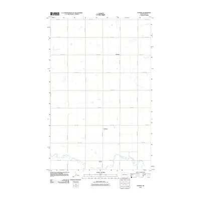
2011 Map of Eckman
USGS Topo · Published 2011About this map
Cut Bank Creek meanders through the southern portion of this North Dakota landscape, providing a sharp contrast to the rigid section-line grid that defines the surrounding prairie. This 2011 survey captures the agricultural heart of Bottineau County, centered around the small settlement of Eckman. The presence of Riverside Cemetery near the creek's edge offers a specific focal point for genealogical research and local history, marking a site of long-standing community importance. Further north, the map identifies the location of Dunning, connected by a network of rural routes such as County Rd 20 and numbered section-line roads like 92nd St NW. The mapping of these thoroughfares reveals the enduring layout of rural township life and the persistent importance of local watercourses in an otherwise structured, surveyed terrain.
Find a feature on this map
21 named features on this map. Tap any name to fly to it.
Don’t see what you’re looking for? This feature index may not catch every label — zoom into the map to look around manually.
Map Details
Editions of this 2011 Eckman Map
This is the sole edition of this map. No revisions or reprints were ever made.
Other maps of this area

1948 · Newburg SW
USGS Topo · 1:24,000

1949 · Glenburn
USGS Topo · 1:24,000

1949 · Newburg SW
USGS Topo · 1:24,000

1949 · Maxbass
USGS Topo · 1:24,000

1949 · Eckman SE
USGS Topo · 1:24,000

1949 · Eckman
USGS Topo · 1:24,000

1949 · Westhope SW
USGS Topo · 1:24,000

1949 · Landa SW
USGS Topo · 1:24,000

1950 · Newburg
USGS Topo · 1:24,000

1950 · Westhope SW
USGS Topo · 1:24,000