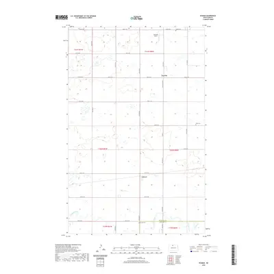
2020 Map of Eckman
USGS Topo · Published 2020About this map
The prairie landscape of the Bottineau and McHenry County border is defined by a grid of agricultural section lines and the meandering path of Cut Bank Creek. Small rural communities like Eckman and Dunning anchor the township, serving as local nodes for the surrounding farmsteads. The importance of family and community history is visible in the preservation of several local burying grounds, including Betania Cemetery, Holden Cemetery, and Riverside Cemetery, which are scattered throughout the quadrangle. Transportation is primarily facilitated by a network of numbered gravel and dirt roads, such as 90th St NW and 84th St NW, while Tengesdal Airport provides a localized aviation point. This survey reflects the enduring structure of the Public Land Survey System, with township and range lines like t160n r80w organizing the North Dakota plains.
Find a feature on this map
25 named features on this map. Tap any name to fly to it.
Don’t see what you’re looking for? This feature index may not catch every label — zoom into the map to look around manually.
Map Details
Editions of this 2020 Eckman Map
This is the sole edition of this map. No revisions or reprints were ever made.
Other maps of this area

1948 · Newburg SW
USGS Topo · 1:24,000

1949 · Glenburn
USGS Topo · 1:24,000

1949 · Newburg SW
USGS Topo · 1:24,000

1949 · Maxbass
USGS Topo · 1:24,000

1949 · Eckman SE
USGS Topo · 1:24,000

1949 · Eckman
USGS Topo · 1:24,000

1949 · Westhope SW
USGS Topo · 1:24,000

1949 · Landa SW
USGS Topo · 1:24,000

1950 · Newburg
USGS Topo · 1:24,000

1950 · Westhope SW
USGS Topo · 1:24,000