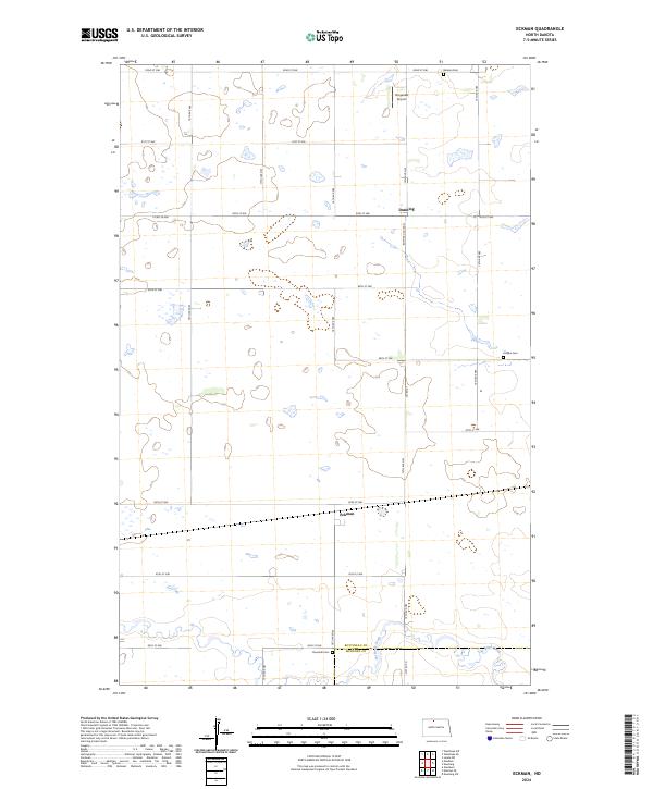
2024 Map of Eckman
USGS Topo · Published 2024About this map
Eckman and Dunning anchor this 2024 landscape in the north-central plains, where the grid of sections and section-line roads creates a precise framework across the Bottineau County Waterfowl Production Area. The terrain is defined by its agricultural layout and numerous small wetlands, characteristic of the prairie pothole region. Local history and genealogy are preserved in the locations of Riverside Cem near the Bottineau and McHenry County line, as well as Holden Cem and Betania Cem farther north. Transportation in the area relies on a network of routes such as Co Rd 21 and 15th Ave NW, while Tengesdal Airport provides a small-scale aviation link. In the southern portion of the quadrangle, Cut Bank Creek winds through the fields, marking the drainage pattern of this rural stretch near the Bottineau and McHenry county boundary.
Find a feature on this map
33 named features on this map. Tap any name to fly to it.
Don’t see what you’re looking for? This feature index may not catch every label — zoom into the map to look around manually.
Map Details
Editions of this 2024 Eckman Map
This is the sole edition of this map. No revisions or reprints were ever made.
Other maps of this area

1948 · Newburg SW
USGS Topo · 1:24,000

1949 · Glenburn
USGS Topo · 1:24,000

1949 · Newburg SW
USGS Topo · 1:24,000

1949 · Maxbass
USGS Topo · 1:24,000

1949 · Eckman SE
USGS Topo · 1:24,000

1949 · Eckman
USGS Topo · 1:24,000

1949 · Westhope SW
USGS Topo · 1:24,000

1949 · Landa SW
USGS Topo · 1:24,000

1950 · Newburg
USGS Topo · 1:24,000

1950 · Westhope SW
USGS Topo · 1:24,000