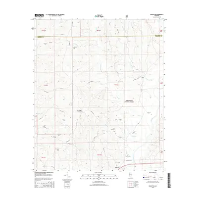
2015 Map of Eddiceton
USGS Topo · Published 2015About this map
The Homochitto National Forest encompasses the rolling creek bottoms and timberlands where the Homochitto River cuts through southwestern Mississippi. This 2015 survey reveals a landscape where modern forestry management overlays a deep layer of local genealogy and settlement. Small communities like Eddiceton and New Hope serve as anchors in a terrain defined by an extensive network of family and community burial grounds, including the Eddiceton Cem, Oak Grove Cem, and Sarepta Cem. The drainage patterns of Fifteenmile Cr, Maxwell Br, and Steep Hill Cr dictate the winding paths of local routes such as Veto Rd and Hospital Rd. This map is particularly valuable for researchers tracing rural lineage across the Franklin and Jefferson county line, as it preserves the locations of numerous historic landmarks like McDanial Cem and Williams Cem that remain significant to the area's social history.
Find a feature on this map
56 named features on this map. Tap any name to fly to it.
Don’t see what you’re looking for? This feature index may not catch every label — zoom into the map to look around manually.
Map Details
Editions of this 2015 Eddiceton Map
This is the sole edition of this map. No revisions or reprints were ever made.
Other maps of this area

1953 · Natchez
USGS Topo · 1:250,000

1956 · Natchez
USGS Topo · 1:250,000

1959 · Natchez
USGS Topo · 1:250,000

1962 · Bude
USGS Topo · 1:62,500

1963 · Union Church
USGS Topo · 1:62,500

1972 · McCall Creek
USGS Topo · 1:24,000

1972 · Little Springs
USGS Topo · 1:24,000

1972 · Caseyville
USGS Topo · 1:24,000

1984 · Brookhaven
USGS Topo · 1:100,000

1984 · McComb
USGS Topo · 1:100,000