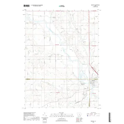
2018 Map of Eddyville
USGS Topo · Published 2018About this map
The Des Moines River winds through the heart of this Iowa landscape, serving as a natural boundary where the corners of Mahaska, Monroe, and Wapello counties converge. The town of Eddyville sits at this tri-county junction, showing a concentrated grid of streets and local landmarks. To the west, the smaller community of Bridgeport and the northern hamlet of Givin reflect the area’s rural heritage. This modern survey highlights a landscape deeply tied to its lineage through numerous family and community burial grounds, such as Henness Cem, Crane Cem, and Muchakinock Cem, often located on high ground overlooking the river valley. The topography is defined by the drainage of various tributaries, including Muchakinock Cr and Bluff Cr, which carve through the agricultural uplands before joining the main river channel.
Find a feature on this map
84 named features on this map. Tap any name to fly to it.
Don’t see what you’re looking for? This feature index may not catch every label — zoom into the map to look around manually.
Map Details
Editions of this 2018 Eddyville Map
This is the sole edition of this map. No revisions or reprints were ever made.
Other maps of this area

1910 · Pella
USGS Topo · 1:62,500

1912 · Pella
USGS Topo · 1:62,500

1929 · Albia
USGS Topo · 1:62,500

1954 · Des Moines
USGS Topo · 1:250,000

1956 · Des Moines
USGS Topo · 1:250,000

1957 · Des Moines
USGS Topo · 1:250,000

1968 · University Park
USGS Topo · 1:24,000

1968 · Oskaloosa
USGS Topo · 1:24,000

1968 · Kirkville
USGS Topo · 1:24,000

1968 · Eddyville
USGS Topo · 1:24,000