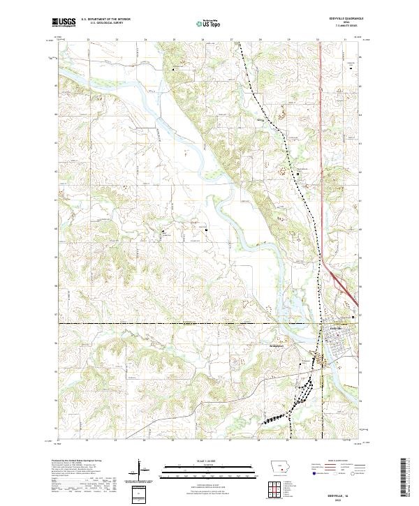
2022 Map of Eddyville
USGS Topo · Published 2022About this map
The Des Moines River winds through this section of southern Iowa, serving as a natural boundary where Mahaska, Monroe, and Wapello counties converge. The settlement of Eddyville sits prominently along the eastern bank, showing a compact grid of streets such as Bridge St and Front St. This area is characterized by its numerous rural burial grounds, including Henness Cem, Muchakinock Cem, and Carpenter Cem, which offer significant value for genealogists tracing early families in the region. North of the river, the small community of Givin is situated near the confluence of local drainages, while Bridgeport lies further south. The landscape is defined by the winding paths of Muchakinock Cr and Bluff Cr, which cut through the terrain to feed the primary river valley, illustrating the historical reliance on these waterways for early settlement patterns.
Find a feature on this map
85 named features on this map. Tap any name to fly to it.
Don’t see what you’re looking for? This feature index may not catch every label — zoom into the map to look around manually.
Map Details
Editions of this 2022 Eddyville Map
This is the sole edition of this map. No revisions or reprints were ever made.
Other maps of this area

1910 · Pella
USGS Topo · 1:62,500

1912 · Pella
USGS Topo · 1:62,500

1929 · Albia
USGS Topo · 1:62,500

1954 · Des Moines
USGS Topo · 1:250,000

1956 · Des Moines
USGS Topo · 1:250,000

1957 · Des Moines
USGS Topo · 1:250,000

1968 · University Park
USGS Topo · 1:24,000

1968 · Oskaloosa
USGS Topo · 1:24,000

1968 · Kirkville
USGS Topo · 1:24,000

1968 · Eddyville
USGS Topo · 1:24,000